


by
IntuVue 3D weather radar provides the most complete and accurate display of weather hazards available from any airborne weather radar.
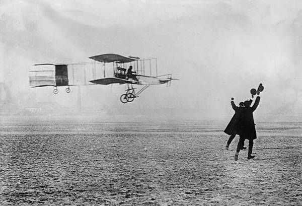
The likelihood of favorable weather was a factor in Wilbur Wright choosing Kitty Hawk, North Carolina for he and brother Orville’s powered flight experiments in 1903. Ironically, a strong gust of wind caught their Flyer aircraft on the ground after its fourth 17 December hop — the fourth controlled, powered flight in history — all but destroying it. Weather has been challenging aviators ever since.
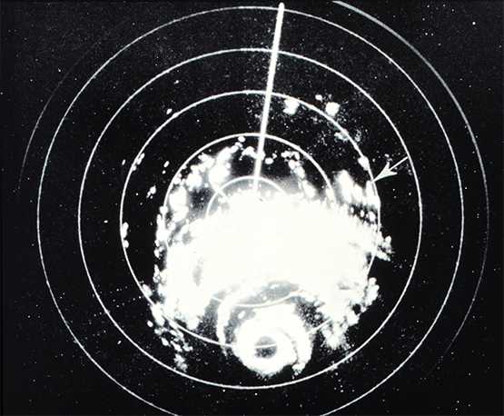
World War II radar operators had struggled with spurious returns from atmospheric precipitation. By the early 1950s the phenomenon had been recognized as a means of weather prediction and dedicated weather radars became widespread in larger commercial and military aircraft during the 1960s.
Scanning in azimuth, traditional weather radars featured a manual tilt function enabling scans at various elevations and creating a 2D image, or slice, of the weather ahead. Considerable pilot skill was required to perform accurate scans and interpret the data as actual weather rather than simple radar returns.
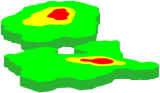
Nevertheless, no angle gave crews all the information they needed and this fundamental limitation in weather radar capability remained even after the tilt process was automated. Honeywell sought to overcome the issue with what became the IntuVue system, also automating the data collection process, so that a three-dimensional picture of weather ahead of the aircraft was generated, rather than a simple slice.
Designated RDR-4000 in its latest commercial application, IntuVue generates 3D weather images through advanced scanning and processing technologies first brought to market about eight years ago.
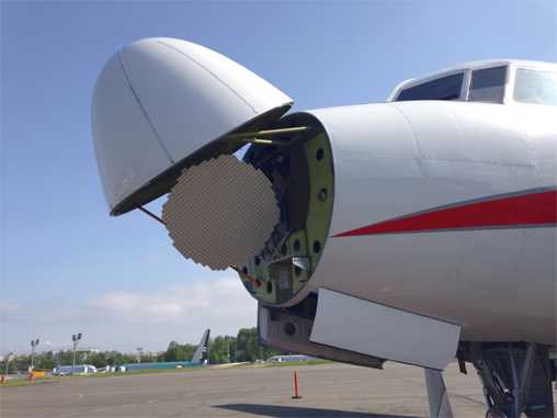
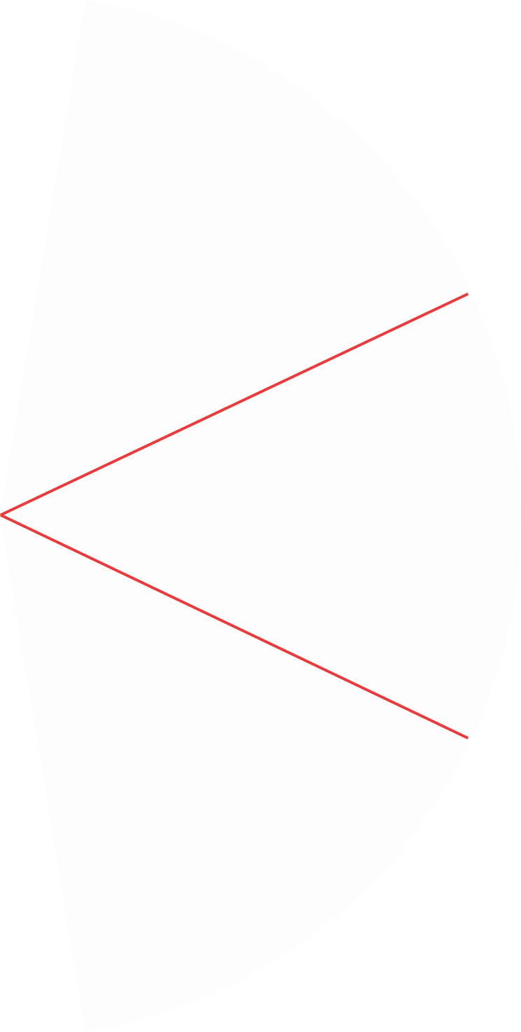
“The system operates at just below 10GHz, using an antenna with a maximum width of 30in, since that is the largest that will fit under the radome at the aircraft’s nose. Those two properties combine to produce a 3 to 3.5 degree circular antenna beam and this defines what the pilots see with the radar,” explains Honeywell Technical Sales Manager Jeff Hester.
“The RDR-4000 performs a scan, then the tilt increases by 1 degree and it does another and so on. Consecutive scans at different tilt angles capture a series of overlapping slices that are pieced together to form a three-dimensional picture. It’s the key technology breakthrough in airborne weather radar.”
- Jeff Hester, Honeywell
Honeywell’s 3D Volumetric Buffer contains a 3D data memory and is the critical component in generating the radar picture, which extends from ground level up to 60,000ft and out to 320nm. The memory is continuously updated, as is the image displayed in the cockpit.
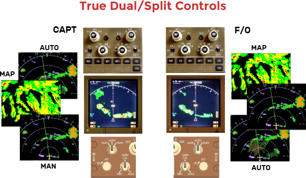
Pilots use the system in “Auto” mode, which delivers an optimized picture without their input, or “Analysis” mode, which enables a more detailed view at different flight levels. Between them, two pilots can use the auto and analysis modes simultaneously and independently.
The manual analysis mode is particularly useful if the radar has detected a convective cell, for example, when the pilots use it to find the cell’s height. It is also useful for looking down through the weather on approach.
“When I was a first officer we were trying to land at Istanbul Sabiha Gökçen Airport in significant weather conditions. There was a build up just at the beginning of the final approach fix, which made it difficult to establish on the ILS,” recalls Captain Cem Alkan, a 737-800 pilot with RDR-4000 European launch customer Pegasus Airlines. “Since we were using RDR-4000 we looked down to 3,000 ft, the platform altitude for establishing on the glide slope, and used the system to examine the weather."
"We could see it was satisfactory to continue the approach for landing, but other aircraft were forced to hold.”
- Cem Alkan, Pegasus Airlines
Clear, concise, easily interpreted data presentation is the key to enhancing safety and improving operational efficiency through weather radar. Honeywell worked with focus groups and pilots to fine tune IntuVue functionality and define display standards.
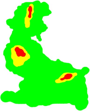
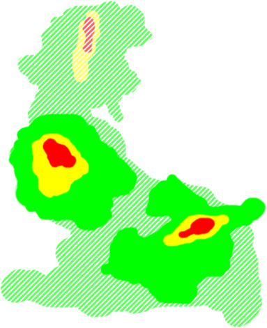
“We have to display the 3D radar image on a two-dimensional display,” Hester explains. “So we defined two categories of weather. ‘On-path’ weather is at the aircraft flight level, plus or minus 4,000ft in elevation, and most likely to directly affect its flight plan. This weather is displayed in solid colors and it’s the weather the pilot needs to be most concerned about,” Hester says.
“Off-path weather is everything else. It could be well above or well below, and we show it shaded out. Combined with on-path weather it delivers complete situational awareness.”
- Jeff Hester, Honeywell
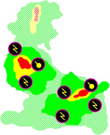
“We’ve also come up with a set of simple symbology, including symbols for lightning and hail.”
The IntuVue system comprises the antenna; antenna pedestal and drive; transmitter/receiver; processor, including 3D Volumetric Buffer; and cockpit displays/control panels. It can be installed as a line fit and is available within Honeywell’s Primus Epic integrated avionics suite, but can also be used as a standalone system and retrofitted. Improvements in technology have reduced the size and weight of radar components, so that the latest generation IntuVue installation is typically 31 percent lighter than the previous version.
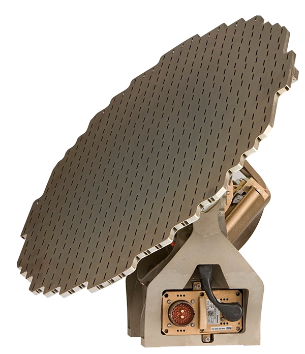
Availability across a variety of platforms is facilitated by a choice of antenna sizes, with 30 inches being the largest available. Antennas are available in 6 inch increments down to 12 inches, suitable for smaller business aircraft. Hester notes that reducing antenna size inevitably affects resolution, with a smaller impact on radar range.
The Single European Sky ATM Research (SESAR) group is integrating crowd-sourced weather data into demonstrations supporting the drive toward Single European Sky.
Weather delays are responsible for 70 percent of commercial air travel delays in both U.S. and European airspace, according to the latest research on aviation weather delays reported by the FAA and Eurocontrol.
Currently, the aviation technology industry is experiencing an evolution in a concept that will greatly aid in the way operators are able to track and avoid pockets of airspace with severe weather and turbulence in real time. This concept is known as crowd sourced weather, in which, effectively every aircraft in the world featuring a form of weather radar can downlink its capturing of information about altitude, position and time components related to patches of airspace with turbulence or severe weather, and then downlink that information to ground-based automation stations. Those stations can then broadcast that information to other airborne aircraft, giving them the opportunity to make real time decisions about avoiding areas of severe weather and turbulence.
Mark Miller, SVP and general manager at The Weather Company, explains that its Pilot Brief system is optimized for real-time inflight use over any IP-based network.
So how does The Weather Company guarantee the veracity of its crowd-sourced data? “Some of it is gathered from our Weather Underground division, which runs a network of 190,000 personal weather stations around the world. They have very robust quality control, but we also take observations from airports, aircraft, satellites, ground radar and other sources. All the information is fed into a numerical model to create an enriched, accurate forecast,” he says.
Through its Weather Information Services product, Honeywell uplinks weather from multiple weather data providers to pilots’ EFBs. It is a useful complement to IntuVue, which gathers and processes data constantly, even though pilots are unlikely to maintain a constant focus on it.
Satellite companies are also contributing to the growth of the crowd sourced weather concept, according to Kenneth Holmlund, chief scientist at EUMETSAT, an organization that provides weather and climate related satellite data to national meteorological services for countries based in Europe.
“With regard to severe thunderstorms we are discussing with the airlines and aerospace industry on what additional satellite data and information on critical thunderstorms could be conveyed to the pilots in the cockpit for real-time adjustments to the route.
Regarding volcanic ash we have since the eruption of Eyjafjallajokull intensified our research in providing more accurate satellite observations of volcanic ash. At the same time the aviation industry has improved their understanding of the impact and risk of volcanic ash on the engines and has been able to refine their requirements for observations,” said Holmlund.
Possibilities exist through leveraging this background radar data collection process to deliver near real-time weather information to other platforms, in the air and on the ground. Hester notes that ground-based radar information is only available from the Continental U.S. and Europe. Honeywell is therefore exploring methods for downlinking data from the IntuVue 3D Volumetric Buffers on multiple aircraft and adding it to crowd-sourced weather. The fused product could even be made available by subscription to operators whose aircraft lack weather radar while compensating for the lack of ground coverage over much of the Earth’s surface and creating a truly global weather picture.